Building in a Fault Zone in California: Geology and the Alquist-Priolo Act
When you are in escrow for a home, or deep in planning a new home, you may learn something new. You may find that your parcel is in an “Alquist-Priolo Earthquake Fault Zone.”
This may appear on the disclosure report or a plan check comment. The news sounds terrifying, and you think, “Does it imply that you can’t construct?”
Let’s be clear right off the bat: being in a fault zone does not mean development is not possible. It initiates a need for further investigation. That investigation addresses one simple question: does a fault trace exist in your building footprint?
This article explains what the Alquist-Priolo Act is and how we map the fault zones. It also explains fault investigation and the consequences of discovering fault beneath your site.
Alquist-Priolo Earthquake Fault Zoning Act
It is an important act of California law that regulates development near active faults since 1972, after the San Fernando earthquake in 1971. The core purpose is to prevent building human-occupied structures across an active fault.
Targeted Hazards
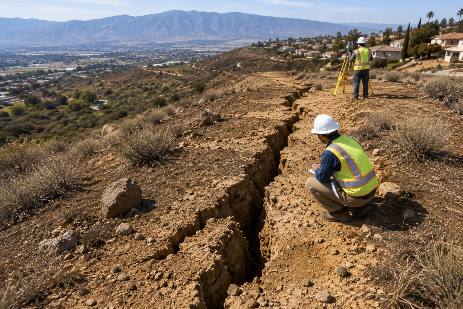
The Act addresses surface fault rupture. The ground physically breaking and offsetting along a fault line during an earthquake is surface fault rupture. A structure straddling a rupturing fault can torn apart a structure straddling over it.
This is distinct from earthquakes, liquefaction, or landslides. California’s Seismic Hazards Mapping Act regulates such hazards separately.
Active Fault
The Act defines an active fault as one that exhibits Holocene (last 11,700 years) manifestation of surface displacement. Considering whether such a fault falls within the definition is what an engineering geologist’s investigation of a site should address.
Mapping Earthquake Fault Zones
The California Geological Survey (CGS) prepares the official Earthquake Fault Zone maps. These regulatory zones typically extend about 500 feet on either side of major active fault traces. Moreover, it is a buffer wide enough to capture uncertainty in fault location. Yet it is not a declaration that every parcel inside contains a fault.
The right fault-zone inspections in Los Angeles will prevent severe project delays and avoid risky project budget issues. Properly framed inspections safeguard schedules, jobs and your project budgets.
How to Check Your Property
- Look up your parcel on CGS’s free EQ Zapp earthquake hazards map application
- Review the Natural Hazard Disclosure (NHD) report from your real estate transaction
- Ask your local building department. For example, LADBS for City of Los Angeles properties, or LA County Public Works for unincorporated areas
Southern California’s mapped zones include segments of well-known faults. For example, the San Andreas, Newport-Inglewood, Hollywood, Raymond, and Sierra Madre systems.
Fault rupture planning is not just a private-development concern. Public agencies like Caltrans include active fault crossings in seismic design. The U.S. Geological Survey supports the fault and earthquake hazard research used in state maps.
Appropriate wall type according to your property depends upon the slope shape, the soil, groundwater, and site access. A geotechnical investigation determines the above-mentioned parameters. On fire-scarred lots, do not assume a soils report written before the fire is still valid.
Burned slopes behave differently compared to the real conditions. So, most cities and counties will require an updated soils study before a new retaining wall approval.
Read more to find out why every property in a fault zone requires soil and geological analysis before any rebuild can occur. Especially when building a foundation for ADU in Los Angeles or retaining wall for a hillside property in Los Angeles.
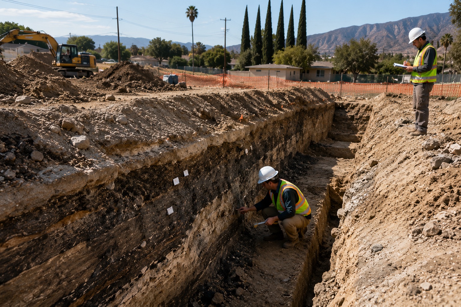
Certified engineering geologist performing a fault trench investigation at a California construction site to identify active fault traces, evaluate surface fault rupture hazards, and support Alquist-Priolo Act compliance before foundation design and development.
Prerequisites for Building
Triggering Projects
The Act covers “structures for human occupancy” – houses, apartments, offices and schools. One exemption is the single-family wood-frame house, although jurisdictions may have more stringent requirements, and additions or remodels may warrant review. Be sure to check with your building department regarding requirements before assuming exemption.
Site-specific geologic investigation
If your project is in a mapped zone and is not exempt, the lead agency cannot issue a permit. A geologic investigation must show that the building site is not on a surface rupture zone of an active fault.
The Investigators
A licensed Professional Geologist should investigate the site, typically a Certified Engineering Geologist (CEG). The city or county’s own geologic reviewers will review the report.
What Actually Happens inside a fault investigation?
A well-run fault study follows a defined sequence:
- Literature and map review — prior fault studies on neighboring parcels, geologic maps, historical aerial photographs
- Field reconnaissance — mapping surface features that could indicate faulting
- Subsurface exploration — fault trenching is the gold standard. An excavator cuts a trench across the suspected fault trend, exposing the soil layers in cross-section. Where trenching isn’t feasible, continuous-core borings or cone penetration tests may supplement or substitute.
On a typical residential lot, expect:
- A trench several feet deep
- Open for days to weeks, with safety shoring
- Some disruption to your yard or landscaping
A good fault study needs to take place in a certain order:
- Trench logging – The trench walls are cleaned, gridded, and logged by the engineering geologist. The work checks for shifted soil layers, shear zones, and similar features.
- Age Analysis – if features are detected, dating of in-wall affected layers – Holocene (active) or older
- Report and agency findings, conclusions, and setbacks if recommended return to agency for approval
A trench may be open for a few days to a few weeks and will be dug on the residential lot. It will use safety shoring and can be several feet deep and will be opened some distance from the house. This will disturb the landscape to some degree.
Safety shoring will be in place. Expect some landscape disruption. Invasive, but the most definitive answer geology can give.
Fault Setbacks: What Happens If a Fault Is Found
Where the investigation indicates an active fault, we would require a 50ft set back from the fault for the structure. We can change the distance on the basis of an approved investigation to site-specific distances.
A setback area does not sterilize your property; however, it depends on the local code. Moreover, some spaces can be within the setbacks, such as driveways, pools, landscaping, or some vacant space.
Then, for your permit approval, you will have an approved report. If there are no active fault lines under the footprint, this will be a valuable document when selling your home later.
What It Means for Buying and Selling Property
California law maintains a Natural Hazard disclosure process. Through this process, sellers disclose whether their property lies within an earthquake fault zone. Zone status can affect buyer perception and, occasionally, lending or insurance decisions.
But a completed, agency-approved fault investigation showing a clear building site largely neutralizes the concern. If you’re selling a zoned property with an approved study on file, feature it.
Costs and Timelines
- Cost: Low five figures for a straightforward residential study; more for complex sites
- Timeline: Several weeks to a few months, including agency review
Fault investigation costs vary widely with trench length, depth, site access, and how quickly datable materials are found. From the low five figures for straightforward residential studies to substantially more for complex sites.
Timelines run from several weeks to a few months, including agency review. The key planning tip: engage the engineering geologist before finalizing your site plan. Finding a required setback after you finish the architecture leads to an expensive redesign.
Money-saving Advice: Money Saving Advise: Appoint the Engineering Geologist before formalizing your site plan. If you need a setback, you can alter the design early on rather than it being a costly redesign in the future.
Conclusion
The Alquist-Priolo Act does not ban building. It is California’s way to ensure buildings are not placed on active faults unknown to landowners.
If your property is in a mapped zone, the next step is clear. A qualified engineering geologist should complete a fault investigation. Your local controlling agency must approve it.
Are you unsure whether your parcel lies in a fault zone or needs an investigation for your permit? Call our Certified Engineering Geologists for agency-approved fault zone screening, trenching studies, and reports. We help keep your project on track.
F.A.Q.s
Can I build a house in an Alquist-Priolo zone?
Yes, in most cases — you just can’t build an occupied structure across an active fault trace. The investigation determines where (or whether) a trace crosses your site.
Does the Act protect against earthquake shaking?
No. It addresses surface rupture only. Seismic Hazards Mapping Act and design handle shaking, liquefaction, and landslide hazards.
How much does a fault study cost?
Typically starting in the low five figures for residential trenching studies, scaling with site complexity. Get a scoped proposal before budgeting.
Do additions or remodels require a fault study?
Sometimes — it depends on the project’s size and your jurisdiction’s rules. Check with LADBS or your county before designing.
Build with knowledge. Build with confidence. Build smart from the ground up.